Obstacle API: Comprehensive Aviation Obstacle Data

Our Obstacle API offers flexible queries, including lookup by aerodrome, point & radius, or polygon. Obstacle data provided by the Obstacle API can be used for a variety of systems and applications.
Access More than 4.5 Million obstacles worldwide
The Obstacle database that powers the Obstacle API contains more than 4.5 million obstacles and is constantly growing.
All known official state sources are covered, such as Aeronautical Information Publications (AIP), electronic Terrain and Obstacle Data (eTOD) and NOTAMs.
Always up-to-date
The obstacle database is updated each AIRAC cycle and always up-to-date.
Obstacle information is published in widely varying formats and degrees of detail. Standardized coding rules are applied to each obstacle to ensure consistency of the data across all sources.
Lido Quality Guaranteed
Quality checks are performed throughout the coding process to ensure the highest quality and correctness of the database.
The data is processed according to the RTCA DO-200B, RTCA DO-276C and RTCA DO-291C standards and regularly audited by EASA (Service Provider Certificate Type 1 certified).
Data and Tools for Diverse Industries: Supporting Multiple Use Cases

Drone OPS
Drone Operations
Drone Planning
EVTOL Operations

Charting
Aeronautical Charting

Flight OPS
Flight Planning
Procedure Design
Performance Calculations

And More...
Research Activities
Mapping Tools

Reliable Sources
The Obstacle API data is sourced from the award-winning Lido Surface Data Obstacles database.
Obstacles are extracted exclusively from authoritative (official state) sources. All authoritative publications, whether they are textual, graphical or digital are taken into consideration and coded in the obstacle database. Some examples of the obstacles sources include the Aeronautical Information Publications (e.g. Amendments, Supplements, Domestic, Visual Approach Charts), Military Publications, Visual Flight Rules (VFR) Publications, Electronic Terrain and Obstacle Data (eTOD), as well as NOTAMs to address short-term and temporal obstacles.
Our team ensures the standardization and consistency of the obstacle data across all sources by applying standardized coding rules in their processes. These also include the georeferencing of published charts to extract the depicted obstacles on them. Data is compliant with all relevant aviation industry standards and is generally processed according to EASA certified processes. Obstacles published in multiple sources are detected and related with each other, to handle redundancy in the database. Quality checks are performed throughout the coding processes to ensure the highest quality and correctness of the database.
Get Obstacles by Aerodrome, Point & Radius or Polygon Area
Different queries are avalaible depending on your use case, giving you data in standardized format.
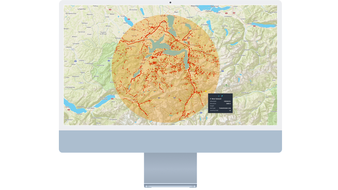
Lookup by Aerodrome
This endpoint allows the querying of all published obstacles in the vicinity of aerodromes using simple requests by airport ICAO code.
Querying obstacle data by AIRAC cycle and pagination features are also available in this endpoint.
Lookup by Point & Radius or Polygon Area
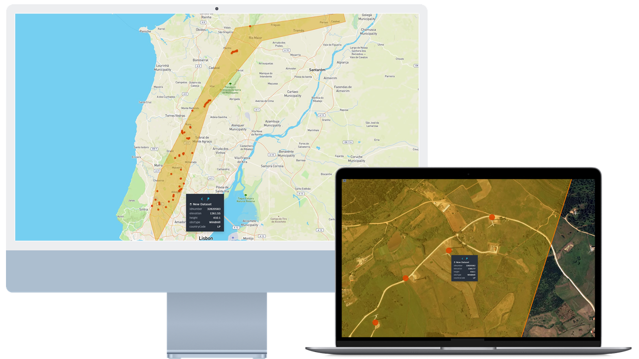
These endpoints allow the querying of all published obstacles within a radius of a specific point location or within a polygon area. This allows for flexibility to receive obstacle information from anywhere on the globe.
Querying obstacle data by AIRAC cycle and pagination features are also available in these endpoints.
Lookup Obstacle Details for each specific object
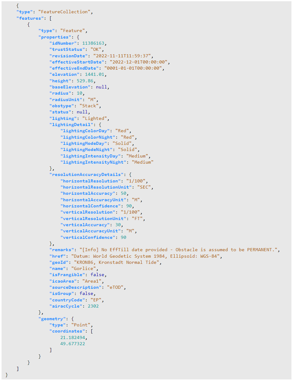
This endpoint allows querying of the complete attribute information for a single or multiple obstacles based on the obstacle ID.
A total of 40 properties are available, including marking, lighting, resolution details and more...
Preview Obstacle Data
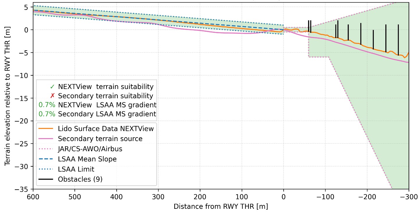
Lido Desktop Assessment Service, powered by our Obstacle API
Avoid costly flight demonstrations and the time intensive aggregation and analysis of different data sources for low visibility operations (LVO).
With new EASA regulations, it is possible to demonstrate LVO compliance by performing a desktop assessment of aircraft and runway relevant data. This process compares the properties of the runway and its surroundings, including obstacles, to requirements dependent on aircraft type and equipment.
Just another example of how powerful the Obstacle API can reveal itself when applied to real-world scenarios!
